Tuesday, December 23, 2014

Bengies Top Ten Movies for 2014

Once again, the giant outdoor screen has gone dark for the winter months, though we have great expectations of the next season. As has been my practice for the past few years (*), I relate below the top ten movies I saw at the Bengies.

14-Apr-2014


19-May-2014


19-Jun-2014. One hour before the box office opens...


23-Jun-2014


28-Jul-2014

18-Aug-2014


03-Sep-2014


04-Oct-2014


03-Nov-2014


In order of my favorites (and Heather's):

  1. The Lego movie
  2. Guardians of the galaxy
  3. Godzilla
  4. Planes 2
  5. Big hero 6
  6. St Vincent
  7. Alexander et al
  8. Box trolls
  9. Maleficent
  10. Spider-Man

(not making the top 10, but entertaining enough to mention)

[///] Turtles
Divergent


And, of course, the Most Honorable Mention::

Jimmy Buffett live in concert


(*)

Thursday, November 20, 2014

Stormwater links and trends


the new MyWATERS Mapper!

 http://www.epa.gov/waters/enviromapper/

http://watersgeo.epa.gov/mwm/

EPA STORET doc (pdf)
STORET data view

copy / paste :

http://iaspub.epa.gov/storpubl/storet_wme_pkg.Display_Station?p_station_id=WHR0006&p_org_id=MDEDAT04_WQX


Functional objectives for stream restoration [ pdf ]

Adopt Your Watershed (has some dead links)

http://water.epa.gov/action/adopt/index.cfm

TOPO maps
https://maps.google.com/gallery/details?id=z4f-ZuCLmiKg.kUOos96GzVzs&hl=en

Sunpapers article
http://www.baltimoresun.com/news/maryland/baltimore-county/white-marsh/bs-md-stream-restoration-20141009-story.html#page=1

WYPR story
http://news.wypr.org/post/baltimore-county-lawmakers-take-another-look-stormwater-fees


Google maps

Windlass run


Stormwater management operational imagery


Drain in front of sediment pond.


Sediment fence, vacant lot.


Fence bottom, undermined?

Sediment pond..
Storm drains..
image rusty manhole cover.

Outside, it is not raining.

The sediment pond is clear, after only a week of not raining.

Tuesday, November 18, 2014

Stormwater surveys, data collection phase

We collected data about stormwater sediment conditions in the Bird River area during the weekend of November 15 and 16, 2014. We were given directions for paper notes, and how to take pictures of what we observed.  I'm going to turn in the paper, but it's faster to make it available online, and I can correct any paper note errors by looking at the sites in Google Earth or maps, or other mapping schemes, including USGS maps.

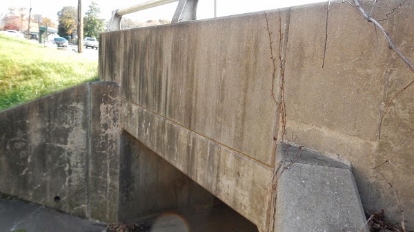
Saturday we looked at a more developed area, so we saw no construction sites.  We did record 5 stream crossings. Several are near the Beltway, and it is obvious from their age they are ripe for a little attention.

Point 1 is White Marsh Run going under Avondale Road, next to I695.


Point 2 is another sturdy bridge, East Avenue.


http://www.panoramio.com/photo/113934039


Third, a trashy, overgrown, logjammed old canal, complete with direct downspout connections (not illegal, but probably against the spirit of anti-pollution laws.

http://www.panoramio.com/photo/113934025


Point 4 - Orbitan Road - 100% paved over on this side.


Point 5... nearby, but logjammed.


Six, the edge of Oak Crest Village...


None of the above have obvious muddy water. Which is to be expected in areas built up 50 or 60 years ago.  It had not rained in a week. Which is why coordinates such as 39° 21' 58.11" N  76° 25' 9.51" W are better in type than in blue ink.

I've tried to link each image with the uploaded picture on Panoramio, but will recheck the validity after a while.

Sunday, we traveled to areas with new construction. More to report.

Not so many stream crossings.  The area is flat and even marshy, but the new MD 43 interchanges were built up, graded, and engineered with new drainage. 

Site 1, Pipe 1.


Fast forward to pipe 2, Bengies Road


Here's a failed erosion fence...


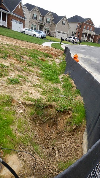
The last shot is a development partly built, partly under construction.  This silt fence is undermined.


http://www.panoramio.com/photo/113966493


Lastly, back on the other side of MD43 where some office parks have taken root and other spaces are yet to be planted.


Next, custom (Google) maps to outline the construction and other areas, and maps of points to be observed during higher rainfall. After the rain.

What else?

  • Where is a list of bridge numbers to mash up against? Someone has inventoried these before.
  •  Lists or Google docs to save notes
  • Stream quality and flow data [ US EPA STORET ]
  • Back ref: Last post

Saturday, November 15, 2014

Stormwater sediment surveying and community participation


In the interest of community spirit, we attended a recent neighborhood meeting about the Bird River water quality conditions. The place was packed, maybe because of the impending election, maybe not.  Speaker Richard Klein went through a slide presentation on basic stormwater sediment control,

Attendees talked about increased silt in the river, and how much deeper the water had been years ago. There was a focus on some of the larger area commercial developments, such as Nottingham Ridge.

Mr. Klein asked the group to participate in improving water quality by working on surveys of conditions at construction sites, fields, etc.

On Saturday (today), we'll meet for training.  Then, a week later, we're supposed to have surveyed the entire Bird River drainage basin.  This will be challenging with the shortening daylight hours.

We're going to be filling out paper forms it seems, and taking pictures, and then a plan.

[LINKS]

Baltimore County

http://resources.baltimorecountymd.gov/Documents/Environment/Watersheds/BirdRiverExecSummary.pdf

http://resources.baltimorecountymd.gov/Documents/Environment/Watersheds/2014/birdriverswappresentation.pdf

http://resources.baltimorecountymd.gov/Documents/Environment/Watersheds/2014/followups1stmeeting.pdf

http://www.baltimorecountymd.gov/Agencies/environment/eir/waterqua.html

Maryland State


http://www.mde.state.md.us/programs/Water/TMDL/Documents/www.mde.state.md.us/assets/document/Appendix_G2_Baltimore_County_Annual_Report_Section_7.pdf

http://mgaleg.maryland.gov/webmga/frmMain.aspx?ys=2012rs%2fbillfile%2fhb0987.htm


Brainstorming

  • Google maps showing areas of concern
  • Panoramio uploads
  • Working with other neighborhood / community organizations


Saturday, September 13, 2014

Pre-Ordeal check list

OA pre-Ordeal lodge membership/inductions checklist.

Election date range


Birth date (youth/adult) can't be missing.


BSA ID can't be blank for lodge membership qualification


Gender can't be blank.


Use of any persons name, living or not, is purely coincidental.

Tuesday, January 28, 2014

OALM Dues from Doubleknot

As receipts are in one system and member data in another, with no connection between, copy and paste is the order of the day.  The first column has the LodgeMaster ID.  Copy each one, and paste it into the corresponding field to retrieve the details.


Then, in the details record, change the paid date to the actual one.


Finally, fill in the receipt number.  The above record shows "GT" for Golden Ticket, meaning that person has an annual pass.

Sunday, January 5, 2014

Nentico 2013 JTE wizardry

OA LodgeMaster JTE (Journey to Excellence) Wizard screens


1 Through 23, with a couple repeats due to window sizing.

Once the wizard work is completed and the JTE submitted, I can't bring these screens up again.  I don't have a way to view the stored data records, meaning these shots are the record of what went into the 2013 recharter.

"Till next year."